The Vital Role of Aerial Photography in Historical Research
Historical Research Using Old Aerial Photos
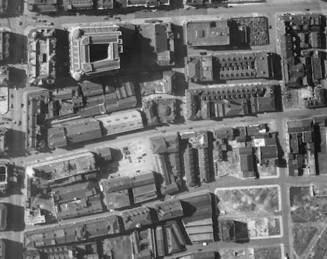
Aerial photography has long been a pivotal tool in historical research, providing unique and invaluable perspectives on our past. From revealing the intricate layout of cities to documenting the transformative changes in landscapes over the decades and especially locating specific sites of interest, aerial photos offer a bird’s-eye view that ground-based photography simply cannot match. These high-angle shots capture details and patterns that are often missed at ground level, making them essential for historians, archaeologists, and researchers alike.
Uncovering Hidden Histories
One of the primary benefits of aerial photography is its ability to uncover hidden histories. Aerial photos can bring to life historical events, for example, the locations of bomb craters following a world war two air raid or the outlines of ancient structures or settlements that have been obscured by modern developments or natural overgrowth. Aerial images can guide excavations ore further research by highlighting areas of interest that warrant further investigation.
Documenting Change Over Time
Aerial photography is also instrumental in documenting change over time. By comparing historical aerial photos from 1945 onwards with contemporary images, researchers can track urban expansion, environmental changes, and the impact of human activities on landscapes. This temporal perspective is crucial for understanding how and why certain areas have developed the way they have, providing insights into urban planning, environmental conservation, and cultural evolution.
The Benefits of Using UK Aerial Photos
For those interested in delving into the rich tapestry of Britain’s past through aerial photography, UK Aerial Photos (https://www.ukaerialphotos.com/old-aerial-photos) is an invaluable resource. This platform offers a vast collection of old aerial photos, meticulously archived and easily accessible for researchers, historians, and enthusiasts.
Comprehensive Collection
UK Aerial Photos offers millions of old and historical aerial photos from the largest photo sources and archives including the historic 1947 RAF survey of many cities across the UK. It's an extensive collection of aerial images dating back to the mid 20th century. This comprehensive archive covers a wide array of locations across the UK, providing a detailed visual record of the country’s development over the decades. Whether you’re looking for images of bustling city centres or tranquil rural landscapes, you’re likely to find exactly what you need.
User-Friendly Search and Purchase
The website’s user-friendly interface makes it easy to find and purchase the photos you want. With a robust search function, users can quickly locate images by entering specific locations or keywords. Detailed descriptions and previews of each photo ensure that you know exactly what you’re getting before making a purchase.
- One search to find old aerial photos sourced from the UK’s largest aerial photography publishers
- Find location by postcode, easting/northing, placename, grid reference, latitude /longitude
- Get the detail you need - from 5cm to 1m resolutions for selected photos
- Preview and download in 1 minute
- Many aerial photos not available on Google
- Verification of date of capture available
- Photos come in a handy PNG format or others on request
- Bespoke search service available for photos not online
Find the historical aerial photos you need: click here.
High-Quality Reproductions
UK Aerial Photos offers high-quality reproductions of their aerial images. These reproductions are perfect for academic research, professional presentations, or personal collections. The clarity and detail of these photos are preserved, allowing you to see the historical nuances and features that are critical for thorough analysis.
Supporting Historical Research
By providing access to these invaluable resources, UK Aerial Photos supports a wide range of historical research efforts. Academics, students, and independent researchers can all benefit from the wealth of information contained in these images. Moreover, the platform’s commitment to preserving and sharing these historical documents helps to keep the history of the UK accessible to all.
Find the historical aerial photos you need: click here.
