Find aerial photos of every county in England
Find aerial photos for every county in England
Aerial photography is an invaluable resource for property and planning disputes, historical research, gifts and marketing property.
At UK Aerial Photos, users can explore a vast archive of over 10 million aerial photographs taken from 1945 to the present day. This comprehensive collection spans every county in England, providing a detailed visual history that is both fascinating and informative.
Search by County:
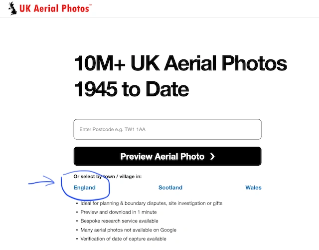
UK Aerial Photos makes it easy to find images from specific counties in England, Wales and Scotland. Take a look here.
Whether you’re researching urban growth in Greater London or rural changes in Northumberland, our platform covers it all. Here’s a glimpse into what you can find:
• Bedfordshire: Explore agricultural changes and urban expansion. Find aerial photos of Bedfordshire.
• Berkshire: Track the development of towns and changes in river courses. Find aerial photos of Berkshire.
• Buckinghamshire: View the transformation of historic estates and countryside. Find aerial photos of Buckinghamshire.
• Cambridgeshire: Discover the evolution of university cities and fenland drainage. Find aerial photos of Cambridgeshire.
• Cheshire: See the industrial heritage and urban growth around major cities. Find aerial photos of Cheshire.
• Cornwall: Uncover the impact of mining and coastal development. Find aerial photos of Cornwall.
• Cumbria: Observe changes in the Lake District and historic market towns. Find aerial photos of Cumbria.
• Derbyshire: Follow the expansion of industrial cities and Peak District conservation. Find aerial photos of Derbyshire.
• Devon: Track coastal erosion and rural development. Find aerial photos of Devon.
• Dorset: View the preservation of historic coastal towns and countryside. Find aerial photos of Dorset.
• Durham: See the industrial decline and regeneration in the North East. Find aerial photos of Durham.
• East Riding of Yorkshire: Discover changes in agricultural practices and coastal towns. Find aerial photos of East Yorkshire.
• East Sussex: Explore the evolution of seaside resorts and rural areas. Find aerial photos of East Sussex.
• Essex: Track suburban sprawl and conservation of historic sites. Find aerial photos of Essex.
• Gloucestershire: View the development of the Cotswolds and urban centres. Find aerial photos of Gloucestershire
• Greater London: Observe the incredible urban growth and infrastructural changes. Find aerial photos of London
• Greater Manchester: See the post-industrial regeneration and urban expansion. Find aerial photos of Manchester
• Hampshire: Track changes from rural countryside to bustling cities. Find aerial photos of Hampshire
• Herefordshire: Discover the preservation of rural landscapes and historic towns. Find aerial photos of Herefordshire.
• Hertfordshire: Observe suburban development and greenbelt preservation. Find aerial photos of Hertfordshire.
• Isle of Wight: View changes in coastal areas and rural landscapes. Find aerial photos of the Isle of Wight.
• Kent: Track urban growth and agricultural development in the Garden of England. Find aerial photos of Kent.
• Lancashire: Discover the transformation from industrial hubs to modern cities. Find aerial photos of Lancashire.
• Leicestershire: See the development of urban centres and rural areas. Find aerial photos of Leicestershire.
• Lincolnshire: View agricultural changes and coastal development. Find aerial photos of Lincolnshire.
• Merseyside: Track the regeneration of Liverpool and surrounding areas. Find aerial photos of Merseyside.
• Norfolk: Discover changes in the Broads and rural landscapes. Find aerial photos of Norfolk.
• North Yorkshire: Explore the preservation of historic sites and natural landscapes. Find aerial photos of North Yorkshire.
• Northamptonshire: View urban expansion and rural conservation. Find aerial photos of Northamptonshire.
• Northumberland: Track changes in the rural north and coastal areas. Find aerial photos of Northumberland.
• Nottinghamshire: See urban growth and the preservation of historic sites. Find aerial photos of Nottinghamshire.
• Oxfordshire: Discover changes in university cities and rural areas. Find aerial photos of Oxfordshire.
• Rutland: View the smallest county’s rural preservation and development. Find aerial photos of Rutland.
• Shropshire: Track changes in market towns and rural landscapes. Find aerial photos of Shropshire.
• Somerset: Observe the evolution of coastal towns and rural areas. Find aerial photos of Somerset.
• South Yorkshire: Discover post-industrial regeneration and urban expansion. Find aerial photos of South Yorkshire.
• Staffordshire: View changes in the industrial Midlands and rural areas. Find aerial photos of Staffordshire.
• Suffolk: Track agricultural development and coastal changes. Find aerial photos of Suffolk.
• Surrey: See suburban growth and greenbelt preservation. Find aerial photos of Surrey.
• Tyne and Wear: Discover the regeneration of urban centres and coastal areas. Find aerial photos of Tyne and Wear.
• Warwickshire: View changes in historic towns and rural areas. Find aerial photos of Warwickshire.
• West Midlands: Track the transformation of industrial cities. Find aerial photos of West Midlands.
• West Sussex: Observe the development of coastal towns and rural landscapes. Find aerial photos of West Sussex.
• West Yorkshire: Discover urban growth and rural preservation. Find aerial photos of West Yorkshire.
• Wiltshire: View changes in historic sites and rural areas. Find aerial photos of Wiltshire.
• Worcestershire: Track the development of market towns and countryside. Find aerial photos of Worcestershire.
Easy Access and High-Quality Images
UK Aerial Photos offers a user-friendly search function, allowing you to locate images by postcode, grid reference, or place name. You can preview and download high-resolution images within minutes, making it convenient for researchers, historians, and enthusiasts. The platform also provides bespoke search services for images not available online, ensuring that you find exactly what you need.
Explore the rich history of England with UK Aerial Photos and uncover the fascinating changes in landscapes and urban development across every county. Visit UK Aerial Photos today to start your journey through time.